By Brenna Wiegand
Marion County Board of Commissioners has until Aug. 15 to render a decision that could pave the way for a rock quarry in Coon Hollow, east of Sublimity.
The canyon cradling Mill Creek is part of the “fine vista and sublime scenery” for which Sublimity was named in 1852. That day’s settlers would smile at the number of descendants who chose to stay, though large tracts of their land are today leased to major growers.
History notes that Sublimity farmers, despite the unsettled character of the region and restless nature of the late 1800s, were content with their land, even choosing to farm only enough of it to fill their basic needs in order to conserve the rest for their progeny.
The rich soil, practically oozing water in places, makes these Mill Creek headlands a haven for timber, Christmas tree and grass seed growing. Generous stretches of plateau are well suited for horses; it’s said the first Marion berry vine was discovered here.
But throughout hill and dale, a recurring geological feature belies the presence of another important natural resource that the grandchildren of pioneer Al Phillips are interested in harvesting – hard volcanic rock known as basalt, which is basic to the construction of roads, railways and buildings.
Some neighbors worry at the effect such a mine will have on noise levels in a place where the church bells of Sublimity are heard, pealing up the canyon. They’re concerned that blasting through the basalt terrace on the creek’s north side will adversely affect the watershed and wildlife; and worried about how roads and traffic will be impacted by trucks carrying off a possible 42.5 million tons of rock over the next 30 or 40 years.
Marion County Public Works estimates a day of peak mine operation will stream an additional 400 truck trips and 40 automobile trips onto local roads, in some spots more than doubling current traffic.
“The roads are going to have to be beefed up big time,” said Roy Basl, who lives on the pastoral farm of his birth. “That’s millions of dollars for someone to pay.”
A 2001 report by the Oregon Department of Land Conservation and Development and the Oregon Department of Transportation explains that such a mine generates frequent truck trips because the aggregate is being used within a 20-mile radius. Any farther away isn’t worth transport costs.
Basl has walked the area since boyhood; he knows the streams that feed Mill Creek, where in the past year he’s spotted rare native cutthroat trout.
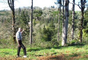
“Good farming tries to protect the ground and the scenery,” he said, pointing across a wooded canyon to the proposed mine site, “but when you scalp the ground, grind it up and haul it away, it will be very offensive to the eye.”
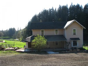
The proposal calls for the eventual mining of about 100 acres, undertaken in five separate, progressive phases spanning 30-40 years, beginning at the site’s southwestern end. The first phase would occur straight out the numerous windows of the Anundi family’s dream home, in the final stages of construction. Adam Anundi claims that on several occasions he was misled as to his neighbor’s intentions for that land.
“I’m very irritated at the thought of having to listen to that for the rest of my life,” he said, doubtful that any measures will be able to keep noise at his home under allowable limits due to the gully’s amphitheater-like shape.
“Unlike any other type of farming or timber operation, who can make all the noise they want any time they want, mining operations have to comply with DEQ standards,” said Jeff Tross, a private land use consultant hired by Phillips Family Trust.
He says the Phillips family has managed timber and farmed in the area for nearly 160 years and has proven themselves good stewards of the land.
“In the past few years, they’ve replanted over 15,000 trees,” said Tross, who helped them prepare a proposal amending the Marion County Comprehensive Plan to include their 405-acre property in its inventory of significant resources, calling it “one of the most complex, expensive procedures in land use.”
“It took over a year just to get something on file with the county,” Tross said. “You have to meet a tremendous amount of standards and there’s a high level of risk.”
All of reports associated with the application are public record, he added.
“Ultimately it’s about change, and people get upset at that, but there’s an obligation for those who oppose to become informed,” he said.
Each mining phase begins with clearing off and stockpiling existing soil and vegetation. After quarrying, “the canyon wall will look like a series of stair steps of about 10-20 feet vertically and horizontally,” said Tross. “The stockpiled organic material is then used to cover those horizontal surfaces.”
Mining reclamation in Marion County, as in most parts of Oregon, is administered by the Mined Land Reclamation Program at the Oregon Department of Geology and Mineral Industries. Mine owners are required to post a bond ensuring mine reclamation is completed.
While some neighbors call this type of harvesting “raping the land,” Tross said there are a number of reasons why it’s an ideal fit. For starters, a large deposit of high-quality rock – the state’s most widely used resource – is situated in a relatively isolated site within reasonable transport to the Valley’s major markets.
Another reason the site is favorable, aside from concentrations of basalt 57 to 76 feet thick, is that, after the mine’s relatively short run, its reclamation will be a relatively simple return to woodland – unlike other second-run sites destined as golf courses, industrial sites or community parks.
“It’s easy to almost overlook them, but mineral and rock resources are of such essential importance in Oregon that the state made a set of specific rules dealing with their protection and provision,” said Tross.
Prior to rendering a decision, the commissioners will hold a public hearing, sending word to those living in the area and anyone else who has requested notification, said Tami Amala, a management analyst with Marion County Planning Division. The de novo hearing will also appear on the board’s agenda, found on the board’s Web site.

