Friday, May 17 was opening day for Shellburg Falls in its post-wildfires state. I had waited long enough.
There is lots of good news to report from a recreation perspective. New infrastructure is in place, including a new trailhead for mountain bikers and a new bridge between the hiking trailhead and the falls.
Yes, there are plenty of burned areas, but the understory already is coming back strong with ferns and seasonal wildflowers. Plus, the reduction in trees, approximately 75 percent according to the Oregon Department of Forestry, has changed many of the views, giving the experience some fresh perspectives. The fires also reduced the amount of shade, it should be noted.
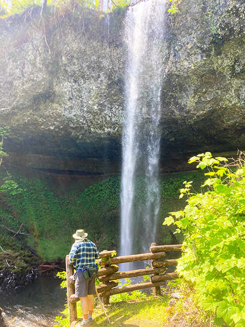
The falls, both the upper and lower set, were running strong, although the workarounds of the ODF has made the lower cascade less-accessible, at least for now.
So let’s hit the trail. The hiking trailhead and day-use area occupies the footprint of the old campground, which the ODF has no plans to reopen. To get there take Wagner Road off of Highway 22 and follow the signs. It’s about nine miles on a good gravel road, although it is narrow enough in spots that two pickups trying to pass each other means a tight squeeze. We passed cars both coming and going, but the visitor total for opening day was relatively light.
The quickest way to the main waterfall, the upper one, is to take the Upper Shellburg Falls trail, which is 0.7 miles to a deadend at the falls. The previous practice of being able to walk behind the falls is no longer an option. ODF officials said the loose rocks and gravel have made it unsafe.
Along the way there are nice views of the falls from the ridge above as well as some challenging switchbacks and steep sections as you descend toward the falls. The problem is that once you are on that path there are no connections between the Upper Shellburg Falls trail and any other trail in the Shellburg system. If 1.4 miles and one waterfall floats your boat, then you’re golden. Otherwise… On the east side of the creek it is a bit more complicated and fulfilling. Via the trails it is 2-plus miles from the trailhead to the falls via the Shellburg Creek Trail, the August Mountain Trail and the Lower Shellburg Falls Trail. However, there is a “maintenance road” that lops off more than half of that distance and connects (although the intersection is unsigned) with August Mountain. The map at the trailhead kiosk indicated the road is “not for public use,” but ODF officials told me that the prohibition was for vehicles, not hikers and bikers.
The ODF plans to install a bridge across the creek that will connect the two trail systems, but it is perhaps as many as five years away, officials said. The upshot, from my single day of hiking/observing is that everyone used the west side trail. We had the east side completely to ourselves.
On the way back to the trailhead we took the August Mountain trail and it’s a fun hike. It has some steep sections that will ensure you get a good workout and it allows you to return to the trailhead via the Shellburg Creek Trail or the Vine Maple Loop. It offers perhaps the most dense tree cover of the post-fire environment.
Another option is to head north from the trailhead and use the Lost Creek Trail to connect with Silver Falls State Park, about 2.5 miles to get to the intersection with the Catamount Trail.